Netherlands in the Future. Second Sustainability Outlook, the physical living environment in the Netherlands
The Netherlands has to fit all of its housing, employment and transport onto a relative small land surface area, while maintaining the quality of the living environment and the landscape. The way to use the available space as effectively as possible is to view these functions and features as an integral whole, including the additional demands made on water management, caused by the effects of climate change.This study shows how optimising the spatial allocation of activities can maximise the sustainability of the Netherlands.
Mapping integrality
Sustainability means that the Netherlands will remain attractive, safe and dynamic for future generations. It is important that central government better coordinates the implementation of existing policies on concentrating housing and employment provision, urban restructuring, National Landscapes, international protected areas and adaptation of hydrological systems (climate change). The new Spatial Planning Act contains specific provisions for this.
Achieving the objectives of all these policies, simultaneously, will only be possible if their land use claims are considered together and the spatial implications mapped out.
Main themes
In the present system, political and administrative decisions on the various social issues are almost invariably taken from a sectoral, and thus partial, viewpoint. This leads to partial solutions and compartmentalisation. To accommodate the current demand for land, while ensuring that future generations inherit a high-quality living environment, we need a more coherent, long-term vision. The sustainability of the physical environment can be broken down into the following main themes:
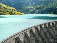
- climate change: flood risks and water damage, water shortages and salt-water intrusion;
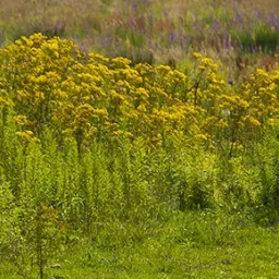
- biodiversity (diversity of plant and animal life): connectivity and quality of the National Ecological Network and Natura 2000 areas;
- traffic and transport: accessibility of cities, congestion on roads, unequal distribution of environmental impacts between different population groups;
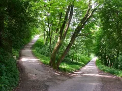
- attractive living environments: shortage of quantitative and qualitative housing (particularly location: green space in urban areas, rural living), and affordability;
- international business location: availability of easily accessible business parks, presence of prime office sites, international hubs (particularly Schiphol), and attractive residential areas;
- cluttering of the landscape.
Conclusions
- This study endeavored to find the most favourable combination of objectives from all the themes (policy fields), resulting in a map of the Netherlands for 2040. The map provides a development perspective that integrates the many different policy goals within a single spatial framework. From this spatial framework and the underlying analysis of synergies and conflicts have led to the following (main) conclusions::
- To accommodate all our needs regarding housing, employment, transport and green space, while maintaining the quality of the physical environment for present and future generations, requires an integrated approach. Only then will it be possible to pursue all the objectives of the different policy fields simultaneously, and achieve more sustainable land-use patterns.
- More coordination between urban development and infrastructure and integration of flood protection measures with nature and landscape conservation offer most benefits. There are also important synergies between farming and nature and landscape quality, and even between flood protection and the climate for new business establishment.
- Existing policy aims offer sufficient opportunities to move towards more sustainable land use in the Netherlands. But such a move would rely on decisive implementation of these policies at local government level and proper recognition of EU policy. Clear plans and the enforcement of existing land-use designations are important prerequisites for a sustainable living environment. Under the new Spatial Planning Act, local structuring plans (structuurvisies) may be used to decide matters of national importance (‘decentralise what you can, centralise what you must’) and must be accompanied by a detailed implementation agenda. From a sustainability perspective, benefits that will accrue in the more distant future should weigh more heavily in political decision making.
- Compact and concentrated new development delivers considerable accessibility gains. These gains are greater under moderate growth in mobility and congestion than from the investments in the road network proposed in the Mobility Policy Document. Investments in infrastructure are more efficient when made in the following order: spatial policy (clustering and intensification) – road pricing – expansions of infrastructure.
- The Randstad shows definite signs of expansion, particularly in the High Development Pressure scenario. New urban areas run as a larger Randstad ring from the coastal zone to Rotterdam, the Brabant city ring, Nijmegen, and Arnhem, on through Amersfoort to Almere and Amsterdam.
- More compact land use works out cheaper, in the long run, than continuing the development of greenfield sites, because management and maintenance costs (e.g. infrastructure, sewerage) rise less. The higher costs of ‘non-compact’ building patterns are passed on to government and future generations.
- In the Combination Map, some of the greenhouse horticulture in the western Netherlands has been moved to the periphery of the Randstad. To alleviate the pressure on space in the west of the country, consideration may be given to creating greenhouse clusters elsewhere in the Netherlands.
- There are many opportunities for synergies with natural habitat development in the river areas (land reserved for widening the river IJssel and for ‘bypasses’ at Kampen and Dordrecht), in the IJsselmeer area and the eastern half of the Green Heart: inundation of the lowest lying land in areas reclaimed from lakes, limit flushing of the polder water system with fresh water from elsewhere (to remove intruding salt water) and development of peat mires.
- A clear land-use planning framework that can bring agricultural land prices under control is a necessary condition for the maintenance and continued development of land-based agriculture as steward of the landscape (National Landscapes) and for effective buffer zones around Natura 2000 areas. Within these areas, financial compensation should be awarded in agri-environmental and landscape stewardship schemes. These may be financed from EU agricultural subsidies, National Landscapes policy and Natura 2000 policy. The reform of the EU Common Agricultural Policy (CAP) in 2013 is an essential, although uncertain, factor here. Co-funding from the Netherlands will also be required.
More information
- This is Part 1 of the Second Sustainability Outlook. Part 2 is called 'The Netherlands in a sustainable world’.
- This report is also available in Dutch: to the report in Dutch
This publication is only available in digital format.
Authors
Specifications
- Publication title
- Netherlands in the Future. Second Sustainability Outlook, the physical living environment in the Netherlands
- Publication date
- 14 July 2010
- Publication type
- Publication
- Publication language
- English
- Product number
- 291